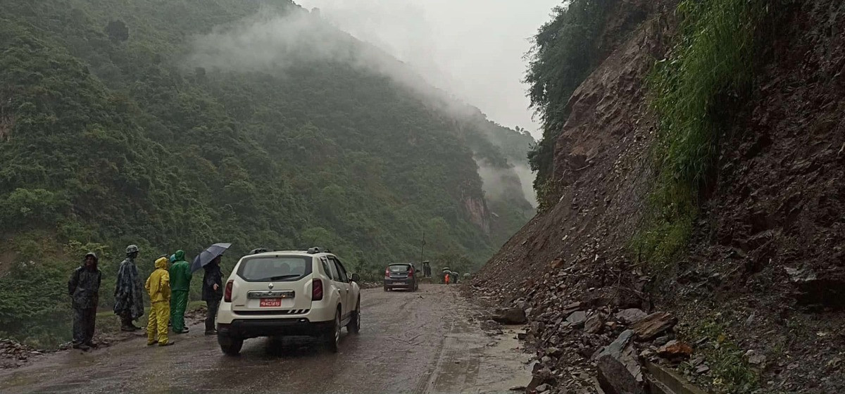
KATHMANDU, OCT 4: At least 16 locations along the Dhading section of the Prithvi Highway and Tribhuvan Highway have been identified as high-risk areas for landslides following continuous rainfall.
A joint inspection conducted on Saturday by the District Disaster Management Committee and a technical team revealed a high likelihood of road collapse and landslides at key points on the main highways leading to the capital.
Chure at high risk of landslides

SP Bhesh Raj Rijal of the District Police Office urged people to remain in safe locations, stating that travel along the highways is currently unsafe. The highest risk has been observed at Juwangkhola in Benighat Rorang Rural Municipality–10.
Other high-risk areas include Jhyaple Khola (an old landslide zone), Tunnel Route, Char Kilo (where the road has sunk), Sat Kilo, Kamere Cliff, Mahesh Dobhan, Chiraudi Bridge, Jarekhet Bridge, Galoundi Bridge, Parewa Cliff, Hilltop Turn, Bandare Turn, Krishna Cliff, and Laltin Bazaar.
According to Chief District Officer Bijaya Raj Subedi, regular vehicle access to these high-risk areas has been restricted. Only emergency vehicles are being allowed passage under the supervision of security personnel.
The Dhading District Disaster Management Committee reported that it is working continuously in coordination with the Department of Roads, police, and local authorities to mitigate risks. Vehicles stranded due to landslides are being safely redirected to their destinations.


_20191222200001.jpg)